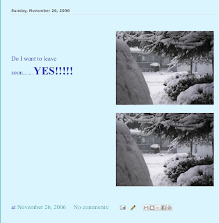
It was a beautiful morning which I spent doing some planning and booking….one of my adventures on the south island of new Zealand will be this hike listed below
Milford Hiking Adventure
Once described as the finest walk in the world, the Milford Track is one of New Zealand’s most popular walks, with approximately 14000 people completing the Milford track each year. This website aims to be a comprehensive information resource on the Milford Track, letting you have all in the information you need in one place. We cover the walk itself, the history of the track, where it's actually located and you'll also find some photos taken by people on the walk. We hope this site answers all the questions you may have.
Interestingly the track may only be walked in one direction, Glade Wharf to Milford Sound, during the booked walking season (late October to late April), with a maximum of 40 independent walkers permitted to start the track each day. Otherwise the track quickly becomes overcrowded and the damage to the environment increases.
The huge valleys that you'll see throughout you trek along the Milford Track are the result of glaciation over the last two million years, these glaciers carved there way through the landscape leaving behind these U-shaped valleys , ice-gouged ledges and the hanging valleys of tributary streams.

Beech trees dominate the forest of the lower clinton, beyond Mintaro the track climbs above the forest through sub-alpine scrub and into the tussocks and alpine herb communities of the pass. The higher rainfall and milder temperatures in the lower Arthur Valley produce a more diverse forest. Ferns, mosses and lichens are abundant around the track. To get a better idea of what you'll see when you're walking why not have a look at the Gallery section of this website. It includes photos people have taken while walking the Milford Track.
If you would like to read a day-to-day break down of exactly what the Milford Track entails,
Milford Track
Most trampers take the launch across Lake Te Anau, a pleasant trip that is a good introduction to the area. The Milford Track is rated easy, but keep in mind it’s a four-day tramp with up to six hours of walking each day.
Stage 1: Glade Wharf to Neale Burn Hut
Time: 1 hour
The track from the wharf is a wide 4WD trail which was once used by packhorses to carry supplies to the huts. In 15 minutes, it passes Glade House, the official start of the Milford Track. The track crosses the Clinton River on a large swing bridge, and continues along the true right (west) side as a gentle path without a stone or a blade of grass out of place. The lower portion of the Clinton, from here to the confluence with the north branch of the Clinton River, has excellent trout fishing.
At one point, the track offers an impressive view of the peaks next to Dare Pass, but most of the walk along the river is through beech forest. It takes only an hour to reach Nealle Burn Hut, the first hut for independent walkers, after leaving the launch at the wharf, This new 40-bunk hut was built after the Clinton Forks Hut was removed in 1997 when the river was threatening to carry it away. At one point it was possible to step off the porch of the Clinton Forks Hut and look at a 3m drop into the Clinton River. Neale Burn Hut has two bunkrooms of 20 beds each, a dining/ common room and an extensive verandah, where you can sit and enjoy the views. Everything is connected by decking and future plans call for an interpretative boardwalk tour of the adjacent swamp. All independent walkers must spend the first night here because the hut at Mintaro will be fully used by the party that left Glade Wharf the previous day.
Stage 2: Neale Burn Hut to Mintaro Hut
Time: 5- 5.5 hours
 The track continues alongside the Clinton River to Clinton Forks, the site of die first overnight halt for independent walkers until 1998. Beyond Clinton Forks, the track heads up the West Branch of the Clinton River. A couple of kilometres past Clinton Forks, the track clambers over the debris from a major landslip in 1982. The avalanche blocked the river and created the lake to the right of the track; dead trees emerge from the water. Whispy waterfalls feather down on both sides of the valley, and a short walk to the left leads to a waterfall view. About Win further along, the guided walkers have a lunch stop near the Hirere Falls. About 4km past Clinton Forks the valley becomes noticeably narrower, with granite walls boxing it in on both sides.
Mackinnon Pass, further up the valley, conies into view for the first time and a short side track curves west (left) to Hidden Lake, on the far side of which is a towering waterfall. The track remains in beech forest until it comes to the Prairies, the first grassy flat. Prairie Lake, at the start of this stretch, is a good place for a swim, since the water is marginally warmer than other lakes in the valley. There are good views from here towards Mt Fisher (1 878m) to the west and Mackinnon Pass to the north. The track reenters bush and begins a rocky climb to the first bus stop shelter, a gloomy lunch stop
9km from Clinton Forks, and then to the deluxe Pompolona Hut, the second night stop for guided walkers.
The track crosses Pompolona Creek via an impressive swing bridge and continues its winding course over low scrub. There are many frame bridges along this stretch before the track ascends more steeply as it passes a side track to St Quintin Falls and eventually works its way to Lake Mintaro and Mintaro Hut. The hut is a 3.5km walk beyond Pompolona Hut. If the weather is clear, you might want to stash your pack and continue to Mackinnon Pass (1073m) to be assured of seeing the impressive views without obstruction from clouds or rain. The pass is a 11/2 to two-hour climb from the hut, and offers a spectacular( ar view at sunset on a clear evening.
Stage 3: Mintaro Hut to Dumpling Hut
Time: 6 hours
The track leaves the hut, swings west with the valley and resumes its climb to Mackinnon Pass. It crosses Clinton River a second time and begins to follow a series of switchbacks out of the bush and into the alpine sections of the route. After 4km at a knee-bending angle, the track reaches the large memorial cairn that honours the discovery of this scenic spot by Quintin Mackinnon and Ernest Mitchell, in 1888.
The track then levels out and crosses the rest ofthe alpine pass and there are impressive views all around of the Clinton and Arthur valleys and several nearby peaks. The two most prominent ~s on the pass are Mt Hart (1782m) and Mt Balloon (1 853m). If the weather is fair, trampers like to spend some extra time at the pass; if it isn’t, they can’t get off it fast enough.
 The track passes several tarns, ascends to the highest point of the walk at 1154m and reaches Mackinnon Pass Shelter before swinging north for the descent. From the pass to Quintin Hut, the track drops 870m over a span of 7km. Soon, the track arrives at Roaring Burn stream, crosses it and reenters the bush. The stream, with its many beautiful waterfalls and rapids is an impressive sight, but the long series of wooden and pierced metal stairways and lookout platforms which trips down the valley beside the stream is almost as eye catching. It was constructed for the 1996-97 tramping season. There are fine views of Dudleigh Falls shortly before Quintin Hut. Quintin, another private hut, has an airstrip, several buildings for guided trampers and a day-use shelter for independent walkers. Nearby is Beech Hut, an historic reconstruction of one of the primitive huts from the early days of the Milford Track. You should consider leaving your pack at Quintin Hut and following the spur to Sutherland Falls (a 1.5 -hour round trip). They are an awesome sight and, for many, the highlight of the tramp.
The track leaves Quintin Hut and descends Gentle Annie Hill, re-entering thick forest, which is often slippery and wet. Here there’s another impressive stretch of wooden walkway, and within 31cm (an hour’s walk) of Quintin Hut, the track arrives at Dumpling Hut (40 bunks), a welcome sight after a long day over the pass.
Stage 4: Dumpling Hut to Sandfly Point
Time: 5.5 – 6 hours
The last leg of the Milford Track is an 18km walk to a shelter on Sandfly Point. The tramp takes most people between five and six hours, and if you plan to meet the 2 pm launch to Milford, you should be out of Dumpling Hut no later than 8 am.
The track descends back into bush from the hut, and soon the roar of Arthur River is heard as the track closely follows the true right (east) bank. After a two-hour walk of 6km from the hut, the track reaches the private Boatshed Shelter (a morning tea stop for guided walkers) and then crosses the Arthur River on a large swing bridge. Just beyond the swing bridge, the track crosses a bridge over Mackay Creek, then comes to the side track to Mackay Falls and Bell Rock. Both natural wonders are a short walk from the main track and worth the time it takes to see them, especially Bell Rock, where the water has eroded a space underneath large enough to stand in. The Mackay Falls may not be a patch on the Sutherland Falls, but they’re still a feature to have your name on!
 The track begins to climb a rock shoulder of the valley, laboriously cut with axes a century ago, above Lake Ada. At one point there is a view of the lake all the to the valley of Joes River. From here, track descends to Giant Gate Falls, the falls on a swing bridge before contuing along the lakeshore. The open shelter just before Giant Gate Falls is a lunch stop if it’s dry. It takes about an hour to follow the lake past Doughboy Shelter, (private hut for guided walkers) through wide open flats at the end of the valley the shelter at Sandfly Point.
Though it is important to be on time to meet the boat at 2 or 3 pm, Sandfly Point not a place to spend an afternoon – it’s a haven for (you guessed it) sandflies. Fortunately, the shelter at the point is reasonably sandfly-proof. The sign marking the end the track is festooned the boots of walkers’ that have made it to the end of the walk not a single step further
If you have the time Google Milford track.net and watch the 18 minute video!!!!
If you do watch the video you will hear mention at the times the luxury accommodation offered by some companies and I have treated myself and booked with a company called Ultimate hikes…I carry my own back back but they provide and cook all the meals and the huts are very well equipped…it should be a fabulous 5 days!!!!
I had the usual Monday afternoon of two different groups of tennis…4 hours in total with a break in between it was very hot but I kept well hydrated and the tennis was really good…..did not get home till 7 o clock and Heather had another lovely meal waiting and then I soaked in the tub, loved that…..and there you go another day done.
I lost a friend today….Gordie passed away this morning after a few years of being very ill my best wishes and prayers go out to Annie and her family!!!
Yashi Kochi!!!


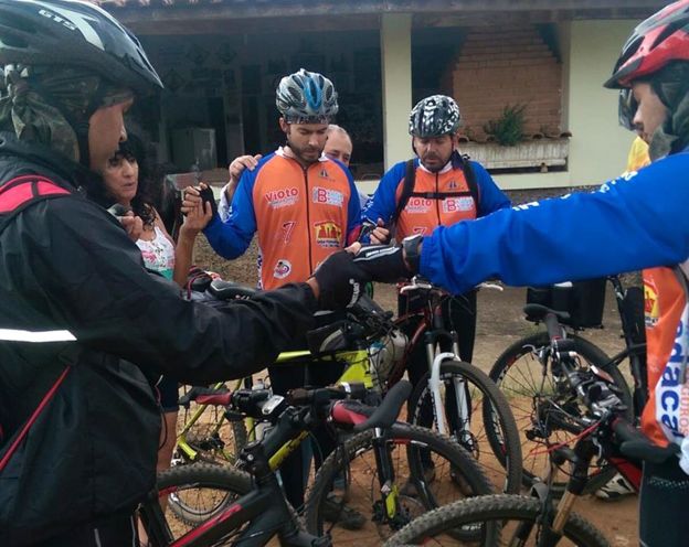 Cyclist-pilgrims join together for morning prayers
 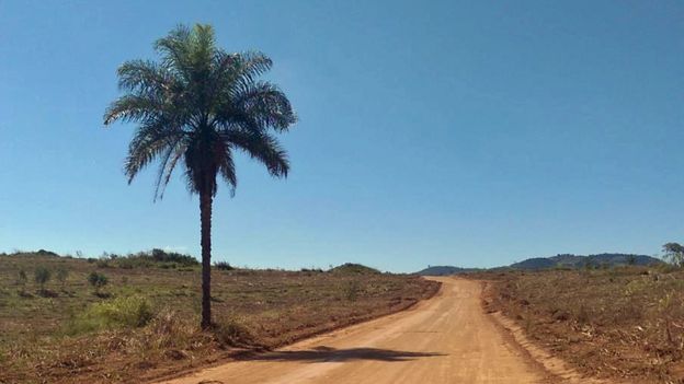 Still no sign of Aparecida...
 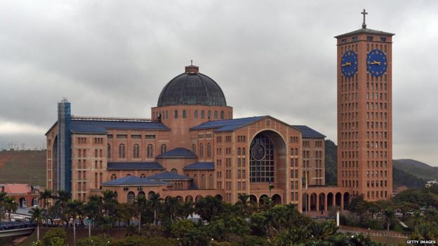 The pilgrimage's final destination - the basilica in Aparecida...
 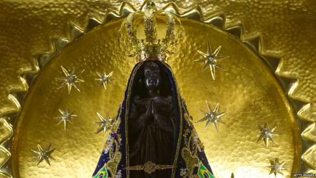 ... and the shrine of Our Lady of Aparecida